Tuesday 5/16/00 21 miles/1996 total. 124 Trail Days. Davenport Gap to Lemon Gap.
It was a short climb out of Davenport Gap, then down about 1200 feet to cross the Pigeon River and I-40. It was early and the 3000 foot climb up Snowbird Mountain was gradual. At Brown Gap I joined Stu (a thru-hiker we gave a ride to yesterday) for lunch along the trail. Just as we finished lunch Colin arrived. I hiked on in order to meet Betty and Mae at our appointed time. The hike across Max Patch Mountain was interesting. At just over 4500 feet elevation, the summit of Max Patch is covered with a large (several hundred acres) grassy field. I met two older local residents who were hiking up the back side of Max Patch as I was descending. Ned and Sam have lived in this area all their lives. Sam was really winded and laid on the ground gasping for air while Ned and I talked. In 1936, when Ned was nine years old, he tagged along with a work crew that cut chestnut trees to clear the mountain top for grazing. Every time Ned would ask Sam to comment, Sam would wave his hand and say nothing; he was ten years younger than Ned, but was really hurting. Ned was loving it, he just kept talking. He said he tried to hike a couple hours on mountain trails at least twice a week. Later, as Sam recovered, they told me how the area was bought by the “government” and the “government” tor down the big old barn and removed fences. Apparently this was when the land was purchased for the Appalachian Trail.
Early afternoon I arrived at TriCorner Knob Shelter. There were no good places to set up camp and I really don’t like to stay inside the dark, damp shelters that smell of smoke and sweat. Nights in shelters are not good for light sleepers; hikers coming and going at odd hours, mice on the move, hikers tossing, turning, talking and snoring. I found a little bowl perched about 15 feet up a hillside. With no trees nearby, it was a challenge to pitch a tarp. Using my hiking stick, I rigged a poor example of a single pole set-up. The evening menu was noodles with parmesan, mixed nuts and Snickers; it was great. I am amazed at how well I can cook outdoors; haven’t turned out a bad meal yet. Eventually, the camp had seven campers with four in the shelter and three of us outside. “Bigfoot from Baghdad”, “Sheephead Joe”, Colin (an avid birdwatcher), Jerry (mid-twenties, light pack and fast pace), George (older, quiet guy) and Amber (young lady from Oregon “doing the Smokies”). Good bunch.
Betty and Mae were waiting at Lemon Gap even though I was a few minutes early. They told me the drive out was long, narrow, steep and rough. They were right on all counts, it was 17 miles on a twisting gravel road, then 26 miles on a sub-standard black top road to a real hiway to take us back to camp. We get to do it all again in the morning; Betty and Mae get to do it twice.
Betty: Since Mae and I were early, we decided to take the dogs, Levi and Susannah, for a walk in the woods. We started down the trail the direction Chuck would be coming up. We soon were walking through Rhododendrons, crossed a small creek, and I had a “very beary” feeling. I told Mae that I was starting to feel “creepy” and Levi and I were heading back. She and Susannah decided to go on. Not long after Levi and I arrived at the car, Mae and Susannah came up the trail. Mae said they got to another creek crossing and there was a fresh bear paw print in the mud. You know they have all kinds of rules about feeding the bears and we didn’t want to violate those rules!!!
Wednesday 5/17/00 22 miles/2018 total. 125 Trail Days. Lemon Gap to Hurricane Gap.
Betty had the video camera out when we arrived at Lemon Gap. She interviewed two hikers who were crossing Lemon Gap as they started their day. “Red Beard” and Jason were happy to tell about their trip. Later in the day I passed “Granny Fox”, she was a little miffed that I had mistaken her for “Sheephead Joe”; all those packs look pretty much the same from the rear view. On the descent into Hot Springs, NC, I caught up with Colin and “Sheephead Joe”. We talked our way into Hot Springs. The AT goes through the middle of town. Even though we passed a tempting restaurant. Colin and “Sheephead Joe” decided a shower had to be their first priority. I hustled on down to the Forest Ranger parking area to meet Betty and Mae. Betty joined me for the 5 1/2 mile hike up to Tanyard Gap. The trail first went alongside the scenic French Broad River, then climbed steeply over the rock banks and out of the river valley. It was good to have the opportunity to hike with Betty. She doesn’t often get a chance to hike and when she does it is not usually convenient for us to hike together. We met “Big Country” sitting at a stream dipping water. Both his frame and his pack had way too much weight. It was after 5PM and he said he had only made about two miles during the day. It seemed only an instant and we were at Tanyard Gap meeting Mae. Betty then drove ahead to meet Mae and I at Hurricane Gap. Mae and I climbed up the side of Rich Mountain. We saw lots of wildflowers. While we stopped to look at flowers, we heard a loud thrashing noise on the right side of the trail. Mae said “Look, it’s a bear”. A black bear was crashing through the underbrush a short distance away on the next hillside. It was twilight when we met Betty.
Mae’s Note: Weaving our way north along the Tennessee/North Carolina border, the rhododendrons are trying their best to share their beauty with all the AT hikers. Buds have been teasing us for days and now we see an occasional one opened. Mountain laurel is in full splendor as are many of the other flowers seen only in this region at these elevations. Betty and I spent a little time in Hot Springs, TN, attending to various business in support of Chuck’s hike. We treated ourselves to a great lunch at the Smokey Mountain Diner which is right across the street from the AT as it passes through Hot Springs. The country cooking served there was topped off with their unique and well-known “home-made chicken flavored ice cream”. Betty and I also took turns hiking with Swamp Eagle and, for my part, my stair climbing exercise at home, is not quite enough to have these legs ready for serious mountain hiking. Thanks to Swamp Eagle’s patience and frequent rest stops along the incline, I was able to get out of the woods before dark. A black bear ran through the woods just about 50 yards beneath our path. I feel very fortunate to have seen it because so many of the “real hikers” have yet to spy one. OK, the bear story is the truth, but I was kidding about the ice cream!!
Betty: The hike was beautiful. The views from “Lover’s Leap” took in the French Broad River and the town of Hot Springs. Chuck didn’t go into detail about “Big Country”, but he is from Texas, here to do however much of the trail he can before the end of the season. When we saw him, he was sitting beside a spring – actually almost in the spring – scooping up water to use in cooking his meal. Actually, I think he was having a good time in the water. He told us not only that he had only made two miles today, but that he had made either 5 or 6 miles yesterday. At any rate, I think he’s enjoying himself. Toward the end of the hike, we walked around a pond and then followed a gravel road for a short distance. As we were entering the woods from the gravel road, we saw a wild turkey. She took off up the hillside, clucking all the way. While I was trying to spot her again on the hillside, we realized she had a chick following her. I got my video camera out and tried to film it, but they were too fast. As I moved slowly forward, hoping to get a shot, another chick ran out from the very spot I had been standing near. The chick had been well trained in keeping silent and still. It was a great day.
Thursday 5/18/00 26 miles/2044 total. 126 Trail Days. Hurricane Gap to Devil Fork Gap.
We had a long day planned and decided to speed it up a little by running the first five miles. Betty and Mae agreed to take my pack and boots to the next trailhead so I could make better time. It felt good to run mountain trails again. In another life we were active with trail running groups. The run became a fast walk on some of the steeper hills, but the miles went by quickly and it was fun. At Allen Gap, I swapped the running shoes for hiking boots, put on my day pack and started up Camp Creek Bald Mountain at about 4800 feet. Someplace on the climb, I overtook “Montana Turtle” a man in his early sixties and aptly named. At Little Laurel Shelter, I stopped for lunch and took a few extra minutes to read through the Trail Register. It was interesting to read the comments of hikers who had passed by this shelter during the previous four months; dozens were there each day in April. Now, only four or five visit daily. Some of the comments are light and clever or humorous, some philosophical, and some sad or depressing. Many of the thoughts fare from the heart; the beauty of the mountains, the solitude, the physical challenge. Some hikers were cold and wet while others passed by on a hot sunny day, some talked of all the new friends they had made on the trail and others were lonely and homesick for friends and family back home.
Back on my own saga, I needed to push on to knock out the mountainous miles and meet Betty and Mae before dark. Over the Blackstack Cliffs, by Jerry Cabin Shelter, up and over Big Rocks brought me to Sheldon Graves. This Sheldon guy was born in 1850, died on July 1, 1863. The grave marker plus a memorial stone were placed there by his “many descendants”. Evidently, the legacy of this 13 year old lives on.
Somewhere going down Flint Mountain, I overtook “Steam Roller” who was limping along with a bad ankle or lower leg. He thought it might be a stress fracture. Such injuries might take weeks to heal and would probably mean he would not make it to Maine this season. It is hard for anyone on a thru-hike to face that thought and it must be especially tough for this active young guy who has a reputation for moving fast on the trail.
Descending the mountain toward Devil Forks Gap, I passed by four hikers off to the right of the trail cooking their evening meal. The only male in the group yelled “Hey, Swamp Eagle!”, it was “Loon”, he was with “Scarlet”, “Lizard”, and “Coops”. This group is with Warren Doyle’s AT2K Expedition of about 15 motivated hikers supported by Warren’s big white van. At Devil Fork Gap, I met Betty and Mae. This was also the day’s end for the AT2K group. “Sawbuck” and “Tennessee Rebel” were watching the gear and supplies that had been stacked by the parking area. Betty and Mae had talked with “Foxtrot” and another lady from AT2K earlier in the day. Several local guys in four different vehicles came speeding into the parking area, slammed on their brakes and were yelling to each other. As I was loading my gear into the Honda, a young guy on a four wheeler cut about a dozen fast “doughnuts” on the gravel parking area a few feet from us. When he emerged from the dust cloud, I flagged him down and reflected on his substandard behavior. He allowed that he may have had a little too much to drink and that he would depart the area. He nodded as he eased out, then gunned the engine, cut one more “doughnut” and waved his finger as he disappeared over the hill. This was the only incident we have had with rowdy folks in nearly five months on the trail.
Betty: This morning we moved the RV forward to Davy Crockett Campground near Chucky, TN. It is a very pretty state park campground and has some full hook-ups.
Before Mae and I headed to the trail to meet Chuck, we took one more trip to Hot Springs. We wanted to pick up some more AT brochures/maps at the National Forest Headquarters. While we were in Hot Springs, we ran into “Sheephead Joe” and “Phalafer” enjoying a much deserved day off. We also got the car washed and talked to “Bunny” who had been debating whether she would go to trail days with us or not. She decided to relax in Hot Springs instead.
Friday 5/19/00 26 miles/2044 Total. 127 Trail Days. Rest Day. “Trail Days” in Damascus, VA.
We have been hustling to get ahead of our schedule so we could take this day off and drive about a hundred miles ahead to “Trail Days” in Damascus, Va. We wanted to see the presentation by “Nimblewill Nomad” and maybe meet other hikers we have known.
It was a good day. Hundreds of hikers were gathered for the event. Some were just hiking through and stayed for the festivities, others had hiked the AT through Damascus weeks before and had hitched a ride back for the celebration. Plus, a few, like us, had not yet hiked to Damascus and would drive back to resume their treks in a day or two. Many thru-hikers from previous years come in hopes of meeting old friends. “Nomad’s” talk was captivating; he is quite a showman. The auditorium was filled and hikers were sitting on the floor and standing along the walls. When “Nomad” finished his rather dramatic and touching performance, he received a very well deserved standing ovation.
We met several hikers we had known before. “Bucky & Sue” were standing in a camping area in front of us as we parked. Betty immediately recognized “Sue” from three years ago when we all met while thru-hiking the Colorado Trail. What a good way for us to start “Trail Days”. We later linked up with the Leuschel brothers, Jon and Dan, who we last saw in White Springs, Fl. on the Suwannee River, they also are going from Key West to Canada. They biked the road portions in order to arrive at the start of the AT early enough to get to Canada before winter. We also met “EZ Duz It”. We had last seen him along the Suwannee River, he was then hiking to get in shape for this, his second, AT thru-hike. The only hiker we saw that we had seen earlier on the AT was “Handyman”. He said his feet are better and that he and “Bluefoot” and his dog “Timber” were going to skip ahead on the AT then come back and do the missed sections later this year or next spring.
“Nomad” is such a celebrity that we only got to chat with him for a few minutes. On 24 May 00, he will be at Cape Gaspe, Quebec in Canada to start a Southbound thru-hike to Key West. We plan to meet on the AT as I am hiking north, probably in upstate New York or somewhere in New England.
The hiking community is dynamic; everyone coming and going, all with so much energy and all having exciting experiences in so many different places. We talked with hikers who had trekked in Nepal, had “walked about” in the outback down under and scores of other interesting trails. I love it!!!
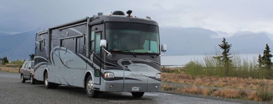
Betty: While in Damascus, we ate at a wonderful eatery, “In the Country”. The owner told us they would be listed in the Appalachian Trail Companion next year. I’m sure it will be a hit with the hikers and also with sightseers. We also checked on campgrounds and found a great one, right on the AT. It is along a creek and has only about seven spaces. We talked to the campground owner and hope there is a space when we get to this point. We are now camped at Davy Crockett State Park. It is a very nice campground on the Nolichucky River. We really enjoy having the RV for, however, the RV we have is a little bigger than is practical for this trail. A smaller RV would be better suited and could be parked in the many parks that have length limits of 16′ or 22′. In addition to the length restrictions at some parks, a smaller RV would travel the small, narrow, winding roads better. As it is, I travel on the backroads with the Honda to pick up and drop off Chuck, and it’s still the best way to “rough it”.
Saturday 5/20/00 8 miles/2052 Total. 128 Trail Days. Devil Fork Gap to Sam’s Gap.
As planned, Mae and her cute little Boston Terrier pup, Susannah, departed for the now long drive back to Naples. I always hate to see my little sister leave, she is fun to be with, crabby, but fun. She and Betty always find interesting things to do and see. We know Mae loves the mountains, especially this area of the Appalachians and that she hated to leave, but that she will be back.
We decided to have a short hike today and catch up on some administrative chores this afternoon. The eight mile hike from Devil Fork Gap to Sam’s Gap was great; long enough to get the heart pumping, but short enough to end before it seemed to drag on for long hours. On the way up Frozen Knob I, again, overtook “Montana Turtle”. I told him about Trail Days and he let me pass before chugging along at his rather slow but constant pace. I like his attitude. He said he doesn’t mind the steep hills or the heavy pack or the long miles; he is just happy to be here “doing it”. Just below the crest of High Rock, I saw a couple having lunch on the side of the trail. The OD (olive drab) rucksacks and MRE’s (meals ready to eat; the modern version of the old “K-Rations” or “C-Rations”) and the guy’s short haircut gave away his military connection. A Marine with six years active duty and now in the Reserves, this guy and his gal were spending a week of their vacation on the AT. We shared a concern about the steady deterioration the armed forces have suffered over the past several years.
Betty was waiting as I hiked down into Sam’s Gap. She drove to a scenic overlook and we had a late, but very pleasant lunch together.
Back at the RV we caught up on some chores and did some planning and map work for the next couple of weeks. I called Dick and “Wezi” Clemmer, my highschool classmates, who live in this wonderful part of the mountains. Dick and I were planning to hike together for at least one day and maybe several days. Since we are about five days ahead of the schedule we had given them, we needed to coordinate some adjustments. On the phone, Dick immediately fired back a new plan: “Recovering from an accident and can’t hike, will be going out of town on business, what are you guys doing right now, let’s meet for dinner”. We met at a steak house in Johnson City. It was a treat to see these old friends. We tried to catch up on years of events that have taken place in all our lives. The evening went by quickly with conversation of family, mutual friends, religion, business, vacations, plans for the future, and on and on. A real pleasure!!
Betty: It’s Sunday and I am at a Hiker’s Hostel in Erwin, TN. You will never guess who I ran into here. “Spider”!! whose name was changed to “Whatever”. He just seems to keep turning up. He recognized the car as soon as I drove up and came out to talk to me. He now has a dog. I don’t know how he acquired a dog and I don’t know whether that’s good or bad. “Steamroller” is also here. He took a couple days off in Hot Springs, but said his ankle seemed to be doing better so he set out on the trail again, however, before long it was giving him trouble again. He plans to stay in Erwin for a few days.
Sunday 5/21/00 24 miles/2076 Total. 129 Trail Days. Sams Gap to Nolichucky River.
On the way to the start point, we checked out the little town of Erwin for a suitable place for Betty to wait and for me to meet her. We had heard some disconcerting reports about Erwin; in Jan Curran’s book he tells about two local guys stalking him, last night Dick Clemmer told us that guys from Erwin tarred and feathered a black man and that they hung an elephant that had killed its trainer. They used a construction crane. We found the perfect place, the Hiker’s Hostel and it is right on the AT.
Betty deposited me at Sams Gap and I started the long climb up Big Bald Mountain (5500 ft). Soon I was in fog and a light mist. Just after completing the seven mile climb to the summit, it started raining. I had already put the pack cover on and now it was time for my rain jacket and rain pants. It was nearly two hours before the rain slacked enough that I could remove the rain gear. It gets pretty warm wearing waterproof shells when hiking in moderate temperatures.
At No Business Knob Shelter, I met two guys from Indianapolis, Steve and Steve. They offered to move their gear to make room for me to toss my bedroll. I told them that I was going on to the Nolichucky River.
It was about 7PM and I still had two or three miles to go, the miles were really dragging. Then I descended low enough that the Mountain Laurel was in full bloom all over the mountainside, what a site. The next awesome event was at a natural overlook on some big rocks. I was looking almost straight down on the Nolichucky River over two thousand feet below. The trail descends into the Nolichucky Gorge through a long series of switchbacks with other overlooks at about 500 foot intervals. It is spectacular. Before I knew it, I was at the Hiker’s Hostel talking with Betty, “Steamroller” and “Flash”. “Sarge”, a former Marine who helps “Uncle Johnny” run the place, thru-hiked the AT in 1997. He is a friendly black man. “Sarge” asked Betty to take a picture of him and I together. It was a long day!
Betty: Mae, “Crabby Trails”, called to let us know that she was back home. I already miss her and Susannah. It was so nice to have someone to wait at trailheads with me, to help with chores and with whom to share the sights and tales.
Monday 5/22/00 19 miles/2095 Total. 130 Trail Days. Nolichucky River to Iron Mountain Gap.
At the Hiker’s Hostel on the Nolichucky River, “Uncle Johnny” and “Sarge” were opening for another day when Betty and I arrived. Betty got out the video camera and asked if she could get them on tape. They were happy to be filmed and started right in on a dialog about the Nolichucky Hostel and the local area.
The trail crawls out of the Nolichucky Gorge and keeps climbing for 14 miles, the elevation gain is nearly 4000 feet. Beauty Spot is a bald with good views for 360 degrees. The trail crosses Unaka Mountain which is over a mile high. It then descends, with a lot of ups and downs to Iron Mountain Gap. On the way down, I met “Cheerio” and “Old Dave” at Cherry Gap Shelter. “Old Dave” was spending the night at the shelter and “Cheerio” was going to Iron Mountain Gap. She asked me to tell her ride to wait for her. Both Betty and “Cheerio’s” ride were waiting when I arrived at the gap. After talking with Dan, “Cheerio’s” driver, whose trail name is “Crawdad”, Betty and I drove a couple of miles into North Carolina to see where Dick and Wezi Clemmer live. We knew they were out of town so we only drove up their lane and turned around. We saw their neighbors watching us from the hillside across the valley. Dick and Wezi had told us that all the neighbors watch out for each other.
Later, back at the RV, Roger Rose called to say that he plans to join us on Thursday. He has an appointment Thursday morning to have a doctor look at the knee that has been giving him trouble.
Betty: Dick and Louisa, “Wezi”, invited us to stay at their house if we wanted to. They also said we could park the RV at their place if we wanted. They live very near the trail and we really appreciated the offers.
While we were talking to Dan, “Crawdad”, he was telling me that he realized as soon as he pulled up, I got in my car and shut the door. Not too obvious, huh? Chuck and I told him that we were concerned about the area because of the things we had read and heard, many of which we haven’t even gone into. Dan said he realized the reputation that Erwin and the area had, and that “Uncle Johnny” has been working hard for the last few years to try to change that. I was so happy to see “Sarge” at the hostel, because that was an indication that some positive changes have been made. Now that Erwin is changing its reputation for the better, we have been told that when we get to the area of the trail that crosses US19E, we had better be careful. Evidently, a faction there is very unhappy about the “government” taking land for a trail and, we were told, there have been incidents of fishline strung across the trail with fishooks hanging from it. Also, there is a shelter about two miles from the trailhead and the “local criminals” go there and terrorize hikers. We have a book called the “Appalachian Trail Thru-Hikers’ Companion” that warns hikers of dangerous areas, it says, “…Hikers are encouraged to stay on the Trail and traverse this section without any unnecessary delays.”
We moved the RV from Davy Crockett State Park Campground to Woodsmoke Campground in Unicoi, TN. This campground is really neat. It is exceptionally clean and well maintained. The campground is family owned and operated. Vega and Richard Crummer and her parents, Urban and Damie Bird, are in the process of expanding the campground and are also putting in a nature trail. They have a computer hook-up and in a few minutes I will go make use of that. Urban Bird is also an artist and has some of his art work in the office. He also teaches art in the area. You can see an artists touch throughout the campground. I love it!!!
Tuesday 5/23/00 10 miles/2105 Total. 131 Trail Days. Iron Mountain Gap to Roan Mountain.
Betty had me at Iron Mountain Gap early. The morning was cool and the trail would be uphill nearly all day. We had heard that the 2500 foot elevation gain was slow going. Shortly after I started, a light drizzle started to fall and continued all day. I covered my pack, but did not put on my raingear. Climbing up the side of Roan Mountain would keep me warm; it gets pretty steamy inside a waterproof rainsuit when the exercise level is high.
About half-way up the mountain I saw “Digger”, an Aussie thru-hiker, checking his map. He had come to the U.S. just to hike the Appalachian Trail.
The top of Roan Mountain is a ridge about five miles long. Because of its height, 6286 feet, it has a cool climate more like that of our forests along the Canadian Border. Areas above the 5000 foot level are covered with Red Spruce and Frasier Fir which were abundant throughout the Southern Appalachians during the last ice age, about 20,000 years ago. As the climate warmed the spruce-fir forests grew only in the more northern forests and on higher mountains in the south. The saleable timber was logged from this area in the 1920’s and 30’s and in 1941 the area became part of the Pisgah and Cherokee National Forest. In the 50’s the balsam wooly adelgid, a tiny insect, infested the Frasier Firs. This critter kills the larger firs leaving the younger trees that become so thick it is dark under a higher canopy of dying firs.
Roan Mountain is well know for the thousands of mounds of rhododendrons which bloom in late June. In the fall the mountain ash has berries which also give the mountain a reddish color. Roan Mountain may have gotten its name from the “roan” color it has in both the Spring and Fall. Some say it was named for Daniel Boone’s roan horse, evidently, Daniel rode his horse here often.
Just as I was crossing the bald on top, I heard a car coming up the road to the visitor’s lookout area. It was Betty, I caught up with her at the parking area entrance. We had planned to meet a mile or so down the other side of the mountain at Carver’s Gap. She was early and was exploring. That sounded like a better deal than hiking, so I called it a day and joined her.
At the Roan Mountain Information booth and Gift Shop we met Patty Polk and Ina Woody. They had a heater going to keep warm while manning the gift shop. These ladies were very helpful as we discussed various birds and flowers that we had seen on the mountain.
An early return to the RV gave me time to catch up on some maintenance projects: I replaced the blades on an exhaust fan in the RV and repaired the CB radio in the Honda. Betty posted the journal on the website and answered some email. It is now time for bed and it is still raining.
Wednesday 5/24/00 15 miles/2120 Total. 132 Trail Days. Roan Mountain to US 19E.
On top of Roan Mountain the fog was thicker than it was yesterday. Betty dropped me off and disappeared into the fog. A few hundred feet away, I hiked past the site of the old Cloudland Hotel. The first hotel was a 20 room log inn built in 1877 by General John Wilder. In 1885 it was replaced with a luxurious 160 room hotel that catered to the upper crust of the day. Guests came during the summer months for the cool, pure air. The hotel was built right on the Tennessee-North Carolina border. A line was painted inside the hotel indicating the actual border. This line ran through the ballroom and the full length of a long dining table. At that time alcohol consumption was legal in Tennessee, but not in North Carolina. Local lore has it that a sheriff from North Carolina would hangout in the ballroom ready to arrest anyone who ventured across the line with a drink. The fancy hotel was dismantled in 1914; only a hint of the foundation remains today.
Hiking across these high balds in a thick fog and the wind blowing at about 20 mph was a treat. These balds cap some of the higher mountains and ridges, they are covered with grass and, on Roan Mountain, some areas have Scottish Heather. Small and large rock outcroppings and a few scattered shrubs dot the pasture like balds. It reminded me of the heather in Ireland and I hoped there was a pub with hot stew and a cold pint of ale on the far side.
Experts do not agree on the origin of the grassy balds. Some say they have been used for continuous grazing. First, by prehistoric animals, then by elk, deer and bison and lastly, by domesticated livestock brought here by the earliest settlers. Shrubs and trees will recapture the balds if left alone, so the Forest Service maintains them by mowing. grazing and selective cutting.
It rained off and on all day and the fog only lifted for a few minutes three or four times. I walked around a bend in the trail and saw a large white-tailed doe only a few feet away. We were both surprised, she leaped into the fog and was gone before I even thought about getting the camera.
While I was having lunch, four college students hiked by and stopped to talk. They gave me some ramp, a plant that grows wild in the cool, moist mountains; it is similar to a large green onion or scallion. I had heard of them before and know they have a potent reputation.
*Smell the Ramp
Smell the Ramp as you hike the mountain way
It looks and cooks a bit like the leek
Sample the tasty Ramp today
and your mates can smell it for a week
At the higher elevation, the Bluets and other wildflowers are still in full bloom even though they are fading lower in the mountains. I spotted several Indian Paintbrushes, the first I had seen since hiking in the Rockies almost three years ago.
At Yellow Mountain Gap an interesting historical marker read:
Yellow Mountain Gap, 1780
September 25: Down Yonder at Sycamore Shoals they gathered.
A thousand men from the Militias of Virginia, North Carolina,
and what is now Tennessee joined forces to resist the British.
This army of independent, overmountain men provided their own horses, rations, and guns.
September 27: They rode up this mountain as the weather turned bitter.
Through this gap they trudged with the snow “Shoe mouth deep”.
Without benefit of supply wagon, surgeon, or chaplain,
the overmountain men continued the 170 miles to Kings Mountain.
There they defeated the British-led loyalists in bloody battle.
They won a significant battle of the Revolutionary War.
At Apple House Shelter, I met “Digger”, “Pooh Bear” with “Conner-dog” (a dog) and Rachael. They would be spending a rainy night in that three sided shelter. Envious, Rachael said she supposed I was going on to a warm dry bed. I told her she was right.
Betty was waiting at US 19E. After a shower, we had Mexican dinners at Amigos restaurant. Then back to our warm, dry RV which is dry-camped in a muddy lot across from a gas station in Hampton, Tennessee.
Betty: It rained all night long and this morning was still raining. Chuck was going to have a long day today and with the rain, it takes longer because you have to be more careful of footing. We were out to the trail about 7AM. As we pulled up to the trailhead, we saw a hiker trying to hitch a ride. I told Chuck “I think that’s ‘Flash'”. Sure enough, it was. We had last seen “Flash” at Nolichucky Hostel. We offered him a ride. As Chuck moved his gear out, “Flash” moved his in. He was going to get a much deserved, big, hot breakfast and then do some laundry. He invited me to come in and have breakfast with him. I had already eaten breakfast, but the coffee and visit sounded great. We chatted about the trail, and our lives. “Flash” aka John Mattes, told me he saw two bear cubs scamper up a tree a couple days ago. He didn’t wait around to see their mom, probably a good thing. He is getting ready to depart the trail for a couple weeks. He will be returning to Wisconsin for some family events. When he returns to the trail, his girlfriend, Heidi, will join him for some hiking. She teaches High School English and has the summer free. After breakfast, I dropped John at the laundromat and went on my way. One of the things we enjoy most about the trail is the people. We hope to see John and Heidi later this summer.
Thursday 5/25/00 19 miles/2139 Total. 133 Trail Days. US 19E to Dennis Cove.
It rained off and on all night. As we pulled into the trailhead a hiker was “hitching” in the rain. Betty said, “Oh, it’s ‘Flash’!” She left me in the rain and picked up “Flash” to take him into town. Later, I learned that they had breakfast then Betty dropped him at a laundromat.
The weather was cool and it was raining so I started the day wearing my rain suit, but after a couple of hours it was a sauna. I pulled off the rain gear figuring I was already as wet as I could get. It felt good to be out of it and in the cool air.
All morning I played leapfrog with Doug and Rachael. They are young thru-hikers with full packs and were keeping up with me and I was only carrying a day pack.
As I rounded a bend to cross a stream, I saw a beautiful black bear just on the far side of the stream, maybe 30 feet away. It dashed back down the trail about 20 feet more. I motioned to Rachael behind me and we stood watching this critter for about a minute. Only seconds before Doug arrived, the bear got a good whiff of us and disappeared into the underbrush. That was a “once in a lifetime” chance to get some really good bear shots in the wild. However, my camera was out of film. I had not reloaded it due to the rain. Anyway, if anyone wants to verify this bear story; see Rachael.
Along the trail, I met “Soul Trek” and “Yogi B” moving south. They are two very experienced AT hikers who started at Harpers Ferry, WV and will “Flip-Flop” after they get to Springer Mountain. This means they will go north to Mount Katahdin, ME and hike south to Harpers Ferry. “Yogi B” said he may “Flip-Flop” all the way to Cape Gaspe, Canada.
After a lot of ups and downs, I stopped at Moreland Gap Shelter for lunch. It was still raining, so a dry shelter was a welcome site. As I was finishing lunch, Doug and Rachael arrived. They planned to cook a meal so I bid them farewell for the day.
The little green Honda was waiting as I hiked into the trailhead. I was surprised to find that Roger Rose (“Boca Pete”) was with Betty. We did not expect him to arrive until later in the evening.
After a shower, we all went to the Watauga Marina “Captain’s Table” restaurant. The view from the dining room was beautiful. The restaurant was high on the side of a hill and looked out across the lake to the mountains on the far side. The food and service were good also. It was a suitable welcome for Roger and send off for Betty. She will leave for Lime Springs, Iowa in the morning.
Friday 5/26/00 13 miles/2152 total. 134 Trail Days. Dennis Cove to Watauga Dam.
Betty was on her way to Lime Springs, Iowa by 6:45am. It is about a day and a half drive. She will be there for her Mom’s birthday on 2 June and be back on the trail with us in about ten days.
Roger dropped me at Dennis Cove then he drove to Watauga Dam and hiked south. We planned to meet about four miles from his starting point. He is testing his knee to see how it holds up to a light hike then will increase the mileage if all goes well. A doctor in Charlotte, NC x-rayed both knees and determined the problem to be caused by arthritis. Exercise, not surgery, was recommended, preferably walking. Needless to say, Roger likes that doctor.
My hikelead down a beautiful path and into the Pond Mountain Wilderness Area to Laurel Falls. The falls are a stunning view, this goes on my list of most scenic trail locations. I must have taken a dozen pictures. Many will be duplicates, because I could not hear the camera advance the roll due to the roar of the falls. Thinking I was not pressing hard enough, I just kept snapping the same picture.
The sunbeams were just peeking over the ridgeline as I climbed the steep trail up Pond Mountain. The views were great plus mountain laurel was in bloom everywhere. I also saw Fire-Pink, Daisies, Squaw-Root and Indian Paintbrush.
Roger was waiting at US321 as planned. His knee seemed to be holding up well so he decided to hike the four miles back to his van. I had lunch along the lake enjoying the warm sunshine. This is the first day without rain for several days. After eating, I headed down the trail about a half-hour behind Roger.
When I arrived at the van Roger was talking with William Carte, a section hiker, who has been hiking the AT for 27 years; he started when he was three. William lives in Live Oak, FL and had just completed a southbound section hike which started at Mount Rogers, north of Damascus, VA. He has now completed hiking the AT from Springer Mountain to Mount Rogers, almost 500 miles. Roger gave him a ride to Hampton.
Since we finished early, we moved the RV to the trailhead on SR 91. Then went into Damascus to find a place to eat.
Saturday 5/27/00 16 miles/2168 total. 135 Trail Days. Watauga Dam to Tennessee SR 91.
Roger had me to the Watauga Dam trailhead and on my way a few minutes after 7am. The trail climbed steeply out of the Watauga Lake basin, more gradually over Horselog Ridge and then eased over the final bit of the Iron Mountains. At one of the higher, more remote, areas (about 4200 feet) is a monument to Uncle Nick Grandstaff. The monument is the bottom eight feet of the stone chimney left from the house he built in 1895. The inscription says it all: Born 1851 Died 1923 He lived alone, suffered alone, died alone.
So far, all of the AT that I have hiked has been on public land: Chattahoochee National Forest, Nantahala National Forest, Great Smoky Mountains National Park, Pisgah National Forest, Cherokee National Forest and the Jefferson National Forest which I will enter tomorrow as the trail crosses into Virginia. Starting in Virginia the AT trailway corridor gets more narrow and has significantly lower elevation after passing Mount Rogers. Within these National Forests and the GSMNP, there have been several designated Wilderness Areas. Today, I hiked through the Laurel Branch Wilderness. These areas have special protection to minimize impact. No motorized equipment is allowed which means all the trail construction and maintenance work is done with hand tools. This can be quite a chore when a single storm may blow several hundred trees across the trail.
The past couple of days I have seen a lot of Shagbark Hickory and Yellow-Poplar. The Yellow-Poplar (also called Tulip-Poplar) is currently in flower with its bright orange and green “tulips”.
We moved the RV to the Hayes Creek Side RV Park in Damascus, VA. Tomorrow I will hike into Damascus and the AT goes through the middle of town and about 50 feet from our RV. A cold beer will be waiting.
Sunday 5/28/00 22 miles/2190 total. 136 Trail Days. Tennessee SR 91 to Damascus, VA.
A cool foggy morning after a hard rain the night before makes for good hiking. Again, I was on the trail by a few minutes after 7am. A few minutes down the trail, a big whitetail buck loped across the path in front of me.
At the trailhead on US421, there was a small styrofoam cooler and a note that it was for AT hikers. It was iced down with cans of Pepsi compliments of: Mary&Dennis@LaurelCreekLodge.com. As I was having a snack with my Pepsi, “H2O Man”, a southbounder, arrived.
Since I had 22 miles to do, I just kept moving all day. The only major stop was about 15 minutes for lunch at Abingdon Gap Shelter. I saw in the register that “Pooh Bear” had seen a Black Bear about 30 minutes before I passed through the same area. At 2:30pm, I crossed the state line leaving Tennessee and entering Virginia.
Roger and I went to Quincy’s for a pizza. This is a local hiker hangout. Roger hiked about 9 miles yesterday and 8 miles today. His knee was just a little swollen this morning but seems to be doing pretty well. I called Betty and the Johnson’s were all gathered at Nancy and Terry’s. It was good to talk with all of them.
Betty: Sunday 5/28/00 I got to Lime Springs yesterday afternoon. It’s always nice to be back. I went to St Paul’s Lutheran church today, that’s where I am still a member. Loved being back. They had a hymn fest today and the congregation chose some of the hymns. One of the neat things they’ve been doing at our church for the last few years is having a coffee hour, prior to church, where they discuss various subjects, some of which are brought up by the pastor and some by the members. It can be a lively discussion at times.
I’ll be in Lime Springs for about a week, Mom’s birthday is Friday the 2nd, so journal entries won’t be updated until after the 6th of June.
Monday 5/29/00 18 miles/2208 total. 137 Trail Days. Damascus, VA to VA 601.
It was one of those rare times when I can hike directly from the RV. I knew that I would pass T.K.’s Deli and planned to have breakfast on my way out of Damascus. It was good! The morning was cool with a light fog and the miles slipped by easily. Mountain Laurel was in bloom all along the trail and in some places the Purple Rhododendron were starting to bloom.
While eating a late lunch, a local hiker, named Roger, came by and we talked as it started raining. Roger was from Abingdon, VA and he hikes the local trails often. We continued to talk as we hiked on up the trail. By now it was really raining and neither of us had on rain gear but we both had covers on our packs. We hiked like this for about an hour and neither of us ever mentioned the rain. Roger reached his Jeep at Summit Cut and I still had a couple of miles to go. Roger Rose, “Boca Pete”, was waiting with his van.
There was a RV parked at this trailhead. It looked as if no one was in it, but as we drove off I saw a silhouette inside. We went back and I met “Baby Ruth”. She is using the RV to support “Rascal” and “Sunny” on their thru-hike. We had heard that they were a few days in front of us, but had not yet met them. “Baby Ruth” seems eager to meet Betty when she returns from Iowa.
Back at the RV park in Damascus, Roger and I had some help in planning our activities and routes for the next few days. Russel Hayes, who owns the park, was born and raised in Konnarock, VA which is only a couple of miles from the trailhead at which we ended today. He had lots of suggestions for places to park the RV and routes to take.
Tuesday 5/30/00 23 miles/2231 total. 138 Trail Days. VA 601 to VA 603.
“The Hills are alive…” What a beautiful day. It’s about 9:30am and I am standing on top of Buzzard Rock on Whitetop Mountain. It was an easy 2000 foot climb up and out of the fog. The sun is shining down on top of the clouds/fog. The views for 360 degrees are great. This is our first day without overcast skies and rain for a while. It is amazing how much a clear day is appreciated after a few days of rain. The trail leads down into a beautiful valley called Elk Garden then another easy climb of about 1000 feet around the side of Mt. Rogers, which is the highest point in Virginia at 5729 feet. The AT goes to a little over 5500 feet and a side trail leads to the summit. This entire area is impressive. It is mostly a bald with only grass and shrubs; the open mountain top provides great views. Large boulders and rock formations dot the mountain tops and ridges. The words of John Muir come to mind:
*Climb the mountains and get their good tidings.
*Nature’s peace will flow into you as sunshine flows into trees.
*The winds will blow their own freshness into you, and the storms their energy,
*While cares will drop off like autumn leaves.
At Thomas Knob Shelter, I met a young lady whose last name is Drinkwater. She worked on trails in South Carolina with “Wanker” (Jon Phipps) of the Florida Trail Association. She now lives nearby in Konnarock, VA. Two other ladies were southbound thru-hikers who had started at Harpers Ferry, WV. They will hike to Springer Mountain then “Flip-Flop” to Mount Katahdin and hike south back to Harpers Ferry. “Aimless” and “Sirocco” were having a good time and seemed to enjoy moving south, counter to most of the rest of us. They said they were meeting “lotsa” folks and would get to meet many of them again someplace north of PA.
Roger hiked up Whitetop Mountain and back to his van then drove to the RV at the day’s ending point. While waiting there at the trailhead, Roger said about 30 hikers cycled through. Some parked their cars and started hiking one direction or the other on the AT, others were just hiking past. He talked with Warren Doyle again, plus many other hikers. We are slowly catching up to Warren Doyle’s AT Expedition 2000 group again. We are now one day behind this fast moving bunch.

Wednesday 5/31/00 23 miles/2254 total. 139 Trail Days. VA 603 to Mt. Rogers Headquarters and Visitors Center.
On the trail at 6:30am, I hiked past a striking little waterfall. The trail was up and down a lot, but no major changes in elevation. Along the way I met “Moxie”, about sixty something, he started this thru-hike a week after he retired. Also, met Franz, who retired from the Army Special Forces eight years ago. We hit it off right away and talked about mutual interests, friends, assignments, etc. As I was leaving “Arrow” arrived, she had hitched a ride to town to get supplies. At some point along the trail, I saw a small copperhead snake. It was about 18 inches long and refused to move off the trail. I helped it aside with my hiking stick.
Roger took two scenic hikes today, first to the falls and then he hiked south from the day’s ending point and met me. We hiked together back to the Mt. Roger’s Visitor Center. A Forest Ranger gave us a lot of information about the area.
We drove to Marion, VA for a Chinese dinner then I called my bride in Lime Springs, Iowa. All is well.