Sunday 7/16/00 17 miles/3025 miles. 185 Trail Days. Wind Gap to Delaware Water Gap.
So here we are in the famous Pocono Mountains. Somehow, the Poconos don’t seem to be any different than the forested, rocky trail that we have been on for weeks.
It rained hard last night but had mostly stopped by 7AM when I hit the trail. During a mid-morning break at Wolf Rocks, “Urban Camper” and his brother-in-law caught up with me. “Urban Camper” has about as many guest hikers as we do.
About three miles west of the Delaware River, the trail enters the Delaware Water Gap National Recreation Area. This is a very popular escape area for the densely populated area around New York City. Every few hundred feet, I met day-hikers climbing the steep trail. The view from Mount Minsi, overlooking Delaware Water Gap is worth the effort and a pleasant sunny afternoon was a bonus.
This gap is really a gorge with the Delaware River and Interstate 80 at the bottom. A walkway on the I-80 bridge leads hikers across the Delaware River and into New Jersey. Betty was waiting at the Delaware Water Gap National Recreation Area Visitors Center. We went back to Wind Gap and drove the RV into New Jersey and to Cedar Ridge Campground. It started raining about one minute after we were parked and hooked-up. We must be living right.
Betty: We were “dry-camping” in Wind Gap. We found a pharmacy that had been closed and had a nice big parking lot which was no longer in use. It made a nice home for a few days. I went to the Trinity Evangelical Lutheran Church in Wind Gap this morning. Pastor Alfred Ruggiero and the congregation welcomed me into their midst. Worshipping with them was a great honor and I hope to visit their church again one day.
Monday 7/17/00 18 miles/3043 total. 186 Trail Days. Delaware Water Gap Visitors Center to Blue Mountain Lakes Road.
Another hard rain during the night, but by the time we arrived at the Visitors Center the rain had stopped. It was an easy 1200 foot climb up Kittatinny Mountain. The 41 acre Sunfish Pond is a beautiful, clear, glacial lake near the summit ridge. The AT passes along the west shore at the water’s edge. This pristine lake reminded me of the lakes in northern Minnesota or Canada; it seemed out of place in New Jersey. A copperhead was trying to hide between some of the large rocks on the lakeside trail. It waited long enough for me to get a picture. Shortly after passing by the snake, two young ruffed grouse exploded into flight right at my feet. I nearly took flight myself.
The views from the ridge across the valley are surprising. I had expected New Jersey to be urban, densely populated, and industrial. There are some farms and a few small villages in the valley and the ridges and hills on the far side of the valley are covered with green forest. It is difficult to imagine that only 40 miles east is one of the largest, most active and important cities in the world.
During lunch, “Urban Camper” and his brother-in-law passed by, then “Guinness” made a short appearance.
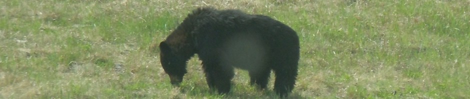
Several people had told me of bear sightings in this area. I saw fresh sign, but no bears to be seen today.
In the late afternoon, while on the home stretch, I met First Lieutenant Schober, He is with the 225th Civil Air Patrol and he was conducting search and rescue training for one of his teams. We talked for several minutes and he told me about their training and search techniques. He is very knowledgeable and loves his work.
Betty had been waiting at Blue Mountain Lakes Road for nearly three hours. She had intended to work at the Mountain Home Hostel, but the minister who manages the hostel foolishly said they did not need help. Any hostel I have ever seen had more work that needed to be done than a 10 man crew could do in a month. I’ve heard that this one is no different.
Betty: Everyone has a bad day from time to time. My last bad day was in Georgia, so I guess I was due another. I had heard and read that the Church of the Mountain hostel will not support hikers who have support (access to a vehicle, RV, etc.), which I think is a good decision, since there are so many thru-hikers and so few services. I like to help out along the trail when I can, and since my drive from the RV to where I was dropping Chuck off was about 45 miles and I dropped him off near the hostel, I thought I would go offer to help with whatever they needed, until it was time to pick him up, rather than make the drive back to the RV. Well, it was a bad idea. The minister was sure we wanted to stay there even though I explained that we had a car and a RV and didn’t want to stay. She couldn’t seem to hear that I just wanted to spend a few hours helping out if there was anything I could do to help, as in take hikers to the grocery store, wash sheets, whatever. Anyway, I left feeling awful. I had talked to “Gaited Mule” prior to going up to offer help. He told me he was out of food and I had offered to take him to the grocery store (about 8 miles up the road), so I did take him to the store which offset the rejection I felt after talking to the minister. It reminded me of what “Nimblewill Nomad” said about one of his trail experiences. He had been on the trail a long time, was looking pretty shaggy, probably smelled pretty bad and had taken a break in a town and was sitting on a bench. A lady and her daughter came out of a store. The woman looked at him, gave her daughter $10 and said “Give it to the man.” Now, little did they know that Nimblewill is a retired doctor, and he didn’t need the $10, but he said to reject their gift would have been to reject them. So, he graciously accepted it and the mother and the little girl went away feeling good about having helped someone. The Church of the Mountains Hostel does a tremendous service to thru-hikers who have no support, and I guess my main disappointment is that I wanted to be a little tiny part of that, and it just didn’t work out.
Tuesday 7/18/00 16 miles/3059 total. 187 Trail Days. Blue Mountain Lakes Road to Sunrise Mountain.
After a late start and a long drive to Blue Mountain Lakes Road, I was ready to start hiking at about 9AM. Then Betty said, “Look, way up the trail, here come “Rascal” and “Sunny”. She hurried to get the video camera and document their appearance. After chatting a few minutes she saw “Urban Camper” and his brother-in-law, Van, now “Alapha”, so she got the video camera out again. Then we saw “Guinness”, so Betty captured his arrival and asked him to tell a little about himself. We topped off their water bottles and offered them soft drinks as we visited for about a half hour. It was a good time, but I did not get on the trail until almost 10AM.
First it was the side trail to Buttermilk Falls, then over Rattlesnake Mountain, and then a stop for lunch on this long narrow ridge line. It was a good spot for lunch, in the shade of a pine tree with a good breeze coming over the exposed ridge. The temperature was forecast to be 88 degrees today so the shade and breeze were a welcome relief from the heat. As is my custom on a hot day, I hung my sweat soaked shirt on a limb to dry and draped my socks on some rocks. The insoles of my boots were also laid on rocks to air and hopefully dry.
The crew that we met at the start point leapfrogged with each other throughout the day. After some cell phone coordination, Betty picked me up on top of Sunrise Mountain.
During the day, Betty had done some grocery shopping at a local supermarket. This part of the country has a different ethnic mix of people and a different variety of foods in the supermarket. For dinner we had Pierogies, a mixture of greek olives, Portuguese bread spread with creme de Brie, and a mixed fruit tumbler. All these goodies were washed down with a little beer and a glass of wine. Life on the road continues to be good. Happy Birthday, EJ.
Wednesday 7/19/00 19 miles/3078 total. 188 Trail Days. Sunrise Mountain to US 284.
A cold front slipped in during the night and it was 48 degrees as we packed our gear this morning. It felt good to hike in cooler weather, the miles seem easier. About 10AM it started raining and continued until mid-afternoon. The sound of the rain on the trees covered the noise of my footsteps and I walked right up on a young buck. We were face to face and about eight feet apart before he made a hasty departure. Within the next hour, I saw three more deer but none nearly so close.
About 11AM, I entered High Point State park. It has New Jersey’s highest point (1761 feet) and a monument on it to make it even higher. Just past High Point, the trail turns eastward and is often directly on the New Jersey/New York state line. The AT will parallel the state line for 27 miles before turning north into New York.
During the afternoon I hiked for an hour or so with “Stretch” and “Sweep”, a young couple from Knoxville. They told me that “EZ Duz It” had taken two days off to hike with some boy scouts. He was their scoutmaster a couple of years ago. Betty and I had been looking forward to linking up with “EZ” again. I first met him hiking in the Osceola National Forest in Florida. Then Betty and I saw him in White Springs, FL and we had dinner together. Our last meeting was in Damascus, VA at Trail Days. I could tell from entries in various trail registers that we were slowly gaining on him. Sorry to miss seeing him, but now we have an excuse to stop by New York City (EZ’s home) on our way back to Florida this fall.
Thursday, 7/20/00 19 miles/3097 total. 189 Trail Days. US 284 to Long House (Brady) Road.
The morning hike was pleasant and uneventful. “Lost Sailor”, “Popcorn” and I hiked more or less together the last two hours before lunch. The “trail telegraph” told us of a country store that has good homemade ice cream. We had lunch at Heaven Hill Store and the ice cream was very good. Since the half-gallon eating episode at Pine Grove Furnace on the fourth of July, I have been avoiding ice cream. Betty is now stocking it in the RV freezer again.
After lunch, Betty just happened to be driving down the road by the Heaven Hill Store. She saw me walking back to the trail and stopped. “Lost Sailor” needed a ride to a hostel, so they drove off while I hiked the steep trail up Pochuck Mountain. It was an easy one thousand foot scramble then easy going the rest of the afternoon.
A few days ago, I met this guy hiking south and thought he was a bum then I was told that he was the first southbound hiker coming from Katahdin, Maine this year. Most of the hikers I have talked with agree; the guy was a bum. This morning, Brian, a trail “Ridge Runner”, confirmed our suspicions. Then late this afternoon I met “Red Dog”, the real first southbounder. We talked for about 15 minutes and I’m convinced that he is legit!
After I met Betty, we went on a wild goose chase to recover the water filter that “Lost Sailor” had left at the shelter early this morning. We drove about 45 minutes on backroads to find that some other thru-hikers had found the filter. They checked with everyone else that was at the shelter and by elimination knew that it must belong to “Lost Sailor”. They hoped to locate him tonight.
Friday 7/21/00 15 miles/3112 total. 190 Trail Days. Long House Road , New Jersey to West Mombasha Road, New York.
We spent the night in a shopping center in Port Jervis, NY. It was dry, level, quiet, dark and free; what more could we ask for? After breakfast we moved the RV forward to Chester, New York. Betty drove me back to the start point at Long House Road in New Jersey. At the trail head, we saw “Popcorn”. We offered him a cold Pepsi then he and I hiked together. He is very independent, set in his ways and proud of it. He lives in the backcountry mountain town of Victor, Colorado. Self employed as a “Wood turner” for spinning and weaving devices, he told his customers to forecast their orders for the next six months and he delivered them before he left to hike the AT.
About noon, we crossed a line painted on the huge rock surface that was the AT. On the west side of the line were the initials “NJ” and on the east side was “NY”. A few minutes later we met “Baby Ruth” who had hiked out a few miles to meet “Rascal” and “Sunny”. “Popcorn” pressed on and I stopped for lunch.
During the afternoon, I met more southbound thru-hikers. As far as I can tell, the order thus far is: “Red Dog”, “Optimist Prime”, “Driftwood Dog” and “Salamander”, and “Tinkerbell” and “Peter Pan”. They told me that they had all been traveling more or less together.
During the afternoon I passed Fitzgerald Falls, a beautiful waterfall about 50 feet high. An hour or so before the end of the day’s hike I overtook “Party Animal”. Minutes later I was on top of Mombasha High Point. It is said that on a good day the New York City skyline can be seen from here. Today must not have been a good day, no skyscrapers were in sight.
Betty was waiting to whisk me back to Chester, NY. We moved the RV to a Family Camp at West Point, NY.
Betty: The West Point Family Campground is another military campground. It is really nice. The sites have water and electric. There is a large pond that the sites look out on. There are several pavilions in the park and the area is well used by military families.
Saturday 7/22/00 23 miles/3135 total. 191 Trail Days. West Mombasha Rd to Bear Mountain Inn on the Hudson River.
It was a long day. Lots of ups and downs, much of it over huge rocks. The last 15 miles of today’s trail was in Harriman State Park. It is a wonderful area for hiking and has many trails other than the AT.
“Party Animal” and I hiked together for about three hours. He is from Baltimore and first thru-hiked the AT in 1981. He said that was back when he really was a party animal. His destination is also Cape Gaspe in Quebec. We shared information concerning the IAT (International Appalachian Trial) and swapped stories about our travels elsewhere.
At one point the trail goes between two large rocks, this tight passage is on the side of a steep hillside and is known as the Lemon Squeezer. My smaller pack made it through fine. “Party Animal” followed without removing his much larger pack. It was a tight fit, but he kept rocking from side to side while steadily pushing forward and made it through.
During the late afternoon the trail descended steeply down Black Mountain and crossed the Palisades parkway. I remembered speeding along this beautiful parkway and thinking that someday it would be fun to scramble around on the rocky hillsides and cliffs. Today was the day.
The last mountain of the day was Bear Mountain, then a steep descent into the Hudson River valley. The views were great and Betty walked up the trail to meet me. This was a beautiful, but tiring 23 mile day.
Sunday 7/23/00 15 miles/3150 total. 192 Trail Days. Bear Mountain Inn to Dennytown Road.
Sunday morning, the AT through the very popular Bear Mountain-Harriman State Park. Activity is beginning all around the Bear Mountain Inn, large picnic areas, ballfields, etc. The trail leads along the southeast shore of Hessian lake; many folks are out for a quiet early morning walk. As I pass by a bench, an older man speaks to me. He is wearing a Disabled American Veteran hat and is seated with his wife and “Uncle Al”. We talk about his experiences in WW II and my hike. His grandson is now a major in the Army, was stationed at Fort Drum, NY and will be moving to Germany soon. I told him how closely that paralleled Suz and EJ’s situation.
AT the edge of the park, the trail goes through the middle of a natural history museum and zoo. The gates to this area were locked, but a little scouting led me around the tall iron fence and down their main walkway. The outdoor exhibits were interesting. A large, maybe 15 foot tall, bronze statue of Walt Whitman had been donated by the Harriman family in honor of their mother, Mary. In the 1920’s Mary Harriman gave the state ten thousand acres and one million dollars for a state park. This grant was the start of the extensive Palisades Interstate park system and provided the land for the first portion of the Appalachian Trial. Walt Whitman, a native New Yorker, poet and naturalist, has inspired millions to seek the solitude and adventure of the outdoors and the “Open Road”. As a kid, my imagination was stirred as I read portions of my mother’s copy of “Leaves of Grass”. Whitman’s statue in this huge park, along this very first part of the AT is most appropriate.
The trail crosses the wide Hudson River on the Bear Mountain Bridge then continues up and down through a forested and rocky corridor moving northeast. Trail maintainer, Bob Reardon, was removing the charred rocks and logs of an “illegal” campfire. He is a member of the Appalachian Mountain Club (AMC) and has volunteered his work on the AT for more than 25 years. Betty was “patiently waiting” for me in Clarence Fahnestock Memorial State Park at Dennytown Road.
Monday 7/24/00 16 miles/3166 total. 193 Trail Days. Dennytown Road to NY Route 52.
Just after starting this morning, I met a photographer returning from an early morning “shoot”. Jerry Sadonic had been photographing mushrooms. I picked his brain for tips to take better photos and wasn’t pleased with the advice. He said: Get a better (and heavier) camera, carry a sturdy (and heavy) tripod and be prepared to spend hours (maybe several different days) and rolls of film to get that one great picture. I thanked him and marched off with my little, light “point and shoot” auto camera and my one and one-half ounce mini-tripod. While photo chatting, “Archon” arrived. We hiked on together for about 15 minutes then he dropped off for a while and I did not see him the rest of the day.
Since Southern Virginia, there have been many old rock fences in the forest. Most are falling down and many have trees growing up through them. This is a very rough estimate but my guess is that I have seen nearly fifty miles of rock fence. Today the trail ran alongside a rock fence for over a mile. Many times the trail crosses rock fences and often those fences extend into the woods as far as can be seen in both directions. Sometimes these rock walls form pens or other squared off areas. Some are fitted together tightly and must have taken a great deal of time and effort to construct, others look to be just long high piles of rock.
Over Shenandoah Mountain, across Taconic Parkway, then over Hosner Mountain and down to meet Betty at New York Route 52.
Tuesday 7/25/00 15 miles/3181 Total. 194 Trail Days. NY Route 52 to NY Route 22.
We moved the RV forward to Walmart/Sam’s parking lot in Fishkill, NY then Betty drove the Honda to my starting point. It was early, cool and the grades were gentle. Before I knew it, I was at NY Rte 55 and a small sign pointing me to the Elite Hot Dog stand. Out along this remote highway was Bob’s Elite Hot Dog vehicle parked on a wide shoulder. I had the Max Burger, fries, ice cream and a Pepsi. Bob chats with each thru-hiker and asks that each sign into his log book. In looking over the past entries I found other Key West to Cape Gaspe entries. “Otter” (Scott Gallaway) passed here on 25 August 1999 moving south, I hoped to meet him in January or February as I hiked north in Florida, but didn’t. “Vagabond Rick” (Rick Guhse), a Florida Trail member, was here on 15 August 1999 section hiking north to Cape Gaspe, I talked with him when he did the Florida Keys section. More recently, “Spur” (Chris Bagby) signed in on his way from Springer Mountain, GA to Cape Gaspe the 2nd of July this year. Since he is 23 days ahead of me we will most likely not meet on this trip. His chances of completing the hike to Cape Gaspe are excellent. Early autumn storms are likely to send us packing back to Florida before we reach the trail’s end.
As I finished the day at Appalachian Trail Station, I found “Wahoo” and “Tigger”. This small 6 foot by 12 foot platform is an actual stop on the railroad, it is a little over an hour to Grand Central Station in New York City.
Wednesday 7/26/00 11 miles/3192 total. 195 Trail Days. NY Rte 22 (Appalachian Trail Station) to Bulls Bridge.
We were on the road early moving the RV forward to Kent, Connecticut. While zipping up I-84 we hit one of the many potholes which set the RV steering into an oscillation that was difficult to control. I thought it must be a blowout and pulled to the side. An inspection of the tires and steering mechanism revealed nothing. We unhooked the Honda and I followed Betty into Kent. Somehow I managed to get on the wrong road and attempted to turn the rig around in the large parking lot of “The Kent Specialized Care Facility”. We thought their mostly vacant lower parking area would be a good location to leave the RV while we scouted for the trail and a place to park overnight. Betty said these facilities are very security conscious and it would be best to ask permission to park. Since Betty recently worked as a hospital social worker and worked closely with assisted living and extended care facilities, I took her advice and went inside to seek permission. Donna, the receptionist referred me to Linda Ford, Director of Recreation. We immediately hit it off; she said we were living her dream. Linda is a hiker and hikes on the AT at every opportunity. We struck a deal; we could park in the lower parking area for a couple of days and in return we would give a short talk to their residents about our trip.
It was 11 AM and raining when we finally got to our start point. We met “Rascal” and “Baby Ruth” there. “Rascal” and I hiked together until about 3PM when his daughter “Sunny” joined us at a road crossing. By this time we had hiked into Connecticut.
Betty picked me up at Bulls Bridge (a covered bridge). We spent a couple of hours in the quaint little town of Kent then returned to our mobil assisted living facility. This was the night to experiment with “Archon’s Margarita recipe. It was a very good mixture and a little experimentation made it even better (Nancy and Linda we need an unbiased opinion).
Thursday 7/27/00 12 miles/3204 total. 196 Trail Days. Bulls Bridge to River Road (3 miles north of Kent).
At 10:15AM, Betty and I gave a talk to about 25 residents of “The Kent”. I told about the hiking portion of our trip and Betty told about the work. She explained how we used the RV to support this long hike. Most of the residents attending our presentation were women and they found Betty’s part of our team interesting. This elderly group asked a lot of questions. We took some pictures that we will share on the web when they are developed and we had a great time. As we finished, Betty went around to every person, she shook their hand and chatted a minute with each one and thanked them for letting us be a part of their community. They all loved it and were eagerly awaiting their turn. One lady, Camilla Donaldson, is 100 years old. She was very interested in our trip and later when she had lunch with her daughter (76) and her granddaughter (47) she told them all about it. Mrs. Donaldson goes for a walk outside everyday, weather permitting, using a rolling walker. Betty and I had a great time with this group. Linda, the Activities Director, had everything organized and is very good at her job, she has an excellent rapport with the residents.
After lunch, Betty put me on the trail at Bulls Bridge. The rain that started two days ago continued through the afternoon. Much of the route was on a ridgeline or on steep slopes, and with wet rocks and slick mud the going was slow. I was especially careful descending from Calebs Peak down over St. John’s Ledges. All of the streams were swollen making crossings a little tricky. My boots and feet remained soaked all afternoon. Other than that it was a good hiking day.
Betty: I believe this is another example of God’s intervention. We could have been just camped in front of another store, but he knew it would be mutually beneficial to us and to the residents of “The Kent” to share our experience. Many of the group who attended our talk had lived in the mountains and hiked and played in them as children and adults, so they have a natural love of the mountains and outdoors, and perhaps this brought back some of those memories. Linda also loves the outdoors and mountains, and shared that she had grown up near Bear Mountain, New York. It was just a wonderful, rewarding experience. I can’t wait to get the pictures back.
Friday 7/28/00 18 miles/3222 total. 197 Trail Days. River Road to US 7 Bridge on Housatonic River (near Rte 112).
We moved the RV from The Kent Specialized Care Facility to downtown Kent near the Post Office. Then Betty took me to the trailhead. The rain stopped during the night, but the trail was still wet and muddy and slick.
After a few miles, I saw a small notice posted on a tree. It informed hikers that in case of highwater they must go back about a half mile then take a one mile detour to get around a small stream that was just ahead. As I approached the stream (not wanting to go around), “Rascal” and “Sunny” waved to me from the far shore. The rocks that normally provide a crossing were submerged and the water was roaring over and around large boulders. A fallen tree provided a 20 foot alternative crossing. When I pointed to the tree crossing, “Rascal” smiled and nodded “yes”. The downed tree trunk was 10 or 12 inches in diameter and a little slippery. I took my time and walked across without incident. “Sunny” introduced me to her friend Jason, who is from Kansas and is visiting her for a week. “Rascal” and I hiked together and lagged about 300 feet behind to allow this young couple some time to walk and talk.
After the hike, Betty and I moved the RV about 30 miles north near Canaan, Connecticut. Betty had arranged for us to park in the Couch-Pipa VFW Post 6851 parking lot. This is a good deal, not only does the VFW let us stay with no charge but, when we went inside to thank them, they bought us a beer. While talking with Jack, the guy seated on the next bar stool, he informed me that the Indians on the Schagticoke Reservation which I had passed through yesterday were hostile. A couple of years ago they actually closed their eight mile portion of the AT. Apparently, the Schagticoke tribe is trying to get some of their native lands returned to them. From now on I’ll keep an eye out for Indians.
Saturday 7/29/00 11 miles/3233 total. 198 Trail Days. US 7 Bridge on the Housatonic River to SR 41 near Salisbury, CT.
It was an overcast day and a little cooler, the miles went by quickly. The trail parallels the east side of the Housatonic River, at one area the local community has incorporated the AT into their walking/jogging path system. At Falls Village the trail crosses the river and leads upriver to the Great Falls. It is a beautiful cascade down about 50 feet with huge boulders and major rapids at the bottom. Enough of the visual refreshment, back in the woods and a gentle one thousand foot climb up Mount Prospect.
The number of rock fences continue to amaze me. They are evidence of the many changes that this area, and our country, have undergone during our relatively short history. This area was Mahican, Mohawk and Schagticoke country, then, about 300 years ago white settlers started clearing the forests in the valleys for homesites and fields. Rocks removed from fields were piled to make fences. A high grade of iron ore was discovered in this area. Limestone was also here to purify the iron and the many rivers provided power for forges and this became one of the country’s major iron producers. Charcoal was needed to process the ore and the remaining trees were cut from the mountain sides. While this part of New England became known for its ironworks esp. bridge iron and guns, their forests were disappearing. After the Civil War ended, the demand for cannons ceased, and many of the foundries closed. Also, by this time coal from Pennsylvania and West Virginia was shipped here to fuel iron processing. The Industrial Revolution had begun and many farms were vacated as better paying jobs drew the work force to urban centers. Idle fields were reclaimed by the forests, new stands of timber were growing on mountain sides and seedlings were sprouting up through rock fences. Now these rock fences are still running for miles but new forests have grown up all around them. Trees two feet thick have grown through some of the rock fences. In some places stone used for foundations, chimneys or cellar walls is still in place. It is easy to imagine an active farm with fields, a garden and all the necessary buildings.
Meanwhile, back on the trail, I have already arrived at the parking area where Betty will retrieve me. But first, a car drives in and a couple places beer, soft drinks and a bag of oranges behind a tree at the trailhead. Trail angels are at work. This time it is “U-Turn” a northbound thru-hiker. His girlfriend from Boston has come to meet him and he will take a few days off the trail. Now is his chance to help other hikers.
The next arrival at the trailhead is David, a Ridge Runner. We talked until Betty arrived. David, “Aneus”, hiked with Nimblewill Nomad in 1998 and was excited to hear that he would be passing through this area in a few weeks.
Back at the RV, Betty and I took care of a lot of little maintenance tasks.
Betty: Getting access to a phone line still remains my biggest headache on this trip. Today I had decided to take my computer along and just go to a library and use their computer to check my messages, but I would need my computer for email addresses. I’ve tried to get phone access at some libraries before, and have never been able to achieve this. When I went in I asked about using the computer and the librarian, Frances, said “Let me get my best computer person.” Shohreh came over and asked what I needed to do, so I explained that optimally, I would like to plug my computer into their phone line, but if that wasn’t possible, I’d like to use their computer to check my messages. She said, “Why don’t we just unplug this computer and plug yours in. Wow!!! What wonderful folks and they really take the frustration out of my “job”. You read the last few pages due to these wonderful people.
Sunday 7/30/00 17 miles/3250 Total. 199 Trail Days. SR 41 to Jug End Road.
As I was turning the RV around behind the VFW, I scraped the right rear panel on a picnic table. This is the same spot on the RV that I rearranged last summer in Minnesota. We moved the RV forward to Sheffield, MA. After we filled the gas tank, we parked behind City Hall along a railroad track.
When Betty deposited me at the trailhead we felt some sprinkles, one-half hour later it was pouring rain and I was soon soaked. My socks were the last to succumb but, between wading through streams and water running down my legs the boots were overflowing.
Most thru-hikers seemed to know better than to be out today. I saw only one other hiker all day. The descent off Bear Mountain was closed due to the rain making the rocks too slippery to be passable. The detour was an additional 2.4 miles which I did not need.
It rained all day so progress was really slow. The steep descent from Mount Everett was especially tricky, I was making only about one mile per hour. At 1PM, I forded a stream in Sages Ravine and was in Massachusetts.
The day was long, cold and wet. My feet were sore from being in water all day and rubbing on wet socks. I was tired from lifting water filled boots over large slick boulders. I knew I was behind schedule and called Betty on the cell phone to change our meeting point to a road that was about four miles closer. I think this is the first time on this trip that we have done that.
About 7PM, as I descended a steep hillside, I could see the little green Honda CRV below. It was especially nice to link up with Betty this evening.
Betty: When we parked the RV behind City Hall, I happened to notice that the First Congregational Church of Sheffield was just a block away and their service was at 10AM. So, when I dropped Chuck at the trailhead, I returned and got ready for church. It was an interesting, old, historic church dating back to the 1700s. Also interesting was that they had a visiting minister who was Presbyterian.
I have a class reunion that is coming up on August 12th. Chuck was going to heft his big pack while I was gone, but we have decided it would do us both good to have a little break, so he will go too.
We will most likely leave the trail about the 10th, spend two days driving to Iowa, spend two days there, and two days driving back.
Monday 7/31/00 13 miles/3263 Total. 200 Trail Days!!! Jug End Road to MA Rte 23, near Great Barrington.
On the trail at 7:30AM and across the Sheffield Valley, this five mile lowland is mostly swamp and is mosquito infested. So far Massachusetts is not at all what I had expected. As I arrived in this old “colony”, I anticipated a rider galloping by yelling “a thru-hiker is coming” and men wearing three cornered hats insisting that I join them for a tankard of ale and women in long black dresses with white aprons and wearing those quaint white caps offering me turkey sandwiches left over from the great feast. I thought that every afternoon at 4PM sharp there would be a proper tea party hosted by the Boston elite, something that might put the Brits to shame. But no, there was no rider, no ale and no tea party. Instead I must ford a knee deep stream just to get into the state and suffer perpetual rain and now I am the feast for a bumper mosquito crop. Other than that it was a good day in Massachusetts.